

Complete Guide to Hiking Landmannalaugar in Iceland
- GoAndXplore
- No Comments
Complete Guide to Hiking Landmannalaugar in Iceland
- GoAndXplore
- No Comments
Facebook
Pinterest
LinkedIn
Twitter
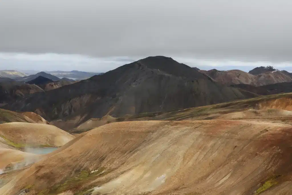
Landmannalaugar is a geothermally-active nature reserve known for its scenic valleys, stunning lava fields, bubbling hot springs, and vibrant rainbow mountains. It’s also a hiking paradise offering every single thing a nature enthusiast or adventure-seeker could wish for.
Despite being more crowded than other popular tourist spots in Iceland, we highly recommend adding Landmannalaugar to your bucket list. Ola and I have already visited this stunning destination two times and we will be for sure visiting again as we still have few more day hikes to finish in this stunning location.
If you’re planning a trip to Landmannalaugar, here’s a detailed travel guide to answer all your questions.
TABLE OF CONTENTS
How to Get to Landmannalaugar?
Landmannalaugar is located in the Fjallabak Nature Reserve in the southern Icelandic Highlands. To visit it, you can either take a bus, join a tour, or drive yourself.
Highland Bus
A number of bus companies operate daily routes from Reykjavik to Landmannalaugar. They also stop at several towns along the way, so you can board from any of these stops.
Reykjavik Excursions starts from Reykjavík campsite, with stops at Selfoss, Hella, and Rjúpnavellir. For 2025, RE will operate from 14th June to 14th September with the bus leaving from Reykjavík at 6:30 and reaching Landmannalaugar at 11:30. The return bus will leave at 15:45 and reach back to the capital at 19:45.
The ticket price is as follows:
Trex starts from Reykjavík City Hall with stops at Kjörbúðin and Landhótel Hella. It will operate 2 buses this year, one from 20th June to 5th September and the other from 27th June to 24th August.
The departure times from the capital are 7:30 and 12:30, and the departure from Landmannalaugar is at 14:30 and 18:00, with the journey taking 4 hours.
The ticket price is as follows:
If you want to explore more options, Sterna and Thule offer somewhat similar packages. Whatever service you select, make sure to book seats at your earliest.
If you plan to travel by bus, you can spend a good part of the day exploring Landmannalaugar’s day hikes and can return back the same night. Otherwise, you can stay and catch the bus another day. But please remember, advance booking is a must!
Landmannalaugar Tours
If you want to focus more on the experience instead of the nitty gritties of your transport, meals, luggage, and accommodation (in case of multi-day excursion), you can join a guided tour. Being one of the most popular hiking destinations in Iceland, almost all tour operators offer one and multi-day packages to this area.
Here are some good Landmannalaugar tours.
| Type | Tour | Days | Price | Booking & Details |
|---|---|---|---|---|
|
Minibus |
L. Hiking Day Tour |
1 |
191 USD |
|
|
Minibus |
L. Pearl of the Highlands |
3 |
1065 USD |
|
|
Minibus |
L. & Háifoss Waterfall |
1 |
€186 |
|
|
Minibus |
L. & Valley of Tears |
1 |
€156.17 |
|
|
Super Jeep |
L. Safari Tour |
1 |
229 USD |
|
|
Super Jeep |
L. Day Tour |
1 |
€316 |
|
|
Super Jeep |
L. Highlands Day Tour |
1 |
43,000 ISK |
|
|
Private Super Jeep |
Customizable As Per Trip |
|||
While joining a guided tour is convenient and stress-free, it costs more and restricts your flexibility to explore. So, in the end, it’s your personal choice.
Driving Yourself
There are two routes to Landmannalaugar – the F225 and F208. Both routes lead to the F224, which eventually leads to the geothermal wonderland. Since the F208 stretches north-south, you can come from either way. This means you have three options to drive there:
- Northern F208
- Southern F208
- F225
You come across a river crossing on the F224 just before the campsite, but you can avoid it by parking your vehicle in the first parking lot (P1) and using the pedestrian bridge. There’s another parking spot after you cross the river.
1. Northern F208 – Easiest Route
If you start from the Golden Circle or the Ring Road (Route 1) in South Iceland, you need to follow this route: Route 1 → Road 30 → Road 32 → F26 → F208 → F224.
This is the easiest route with no river crossing, so it can be a bit boring for some people. Just the last 26 km (after you pass the hydroelectric station on F208 or Fjallabaksleið Nyrðri) are unpaved.
2. Southern F208 – Most Difficult Route
The southern F208 is considered one of the country’s most scenic F-roads. However, this route is the most difficult out of the three.
There are multiple river crossings, with some being quite deep. And since you can never be sure of Iceland’s weather, a downpour can make your way more tricky. The road also has extremely rough sections with large potholes.
3. F225
This is the western route. You can access this F-road (named Landmannaleið) from route 26. The route is rougher than the Northern F208 and also has one river crossing. But thankfully, it’s a small and easy one.
The F225 is also a picturesque road, with its biggest highlight being the Hekla volcano. It’s also the shortest route by distance.
Distance From Key Areas
The drive from Reykjavik takes about 3 hours and 15 minutes, but depends on weather and road conditions. The driving distance and time from some of the key areas is as follows:
| Area | Driving distance | Driving time | Road |
|---|---|---|---|
|
Reykjavik |
187 km/116 mi |
3h 15 min |
F/Gravel |
|
Vik |
121 km/70 mi |
2h 30 min |
F/Gravel |
|
Hella |
100 km/62 mi |
2h |
F/Gravel |
|
Hvolsvollur |
113 km/70 mi |
2h 10 min |
F/Gravel |
|
Selfoss |
138 km/85 mi |
2h 20 min |
F/Gravel |
Here’s the location of Landmannalaugar on Google Maps
Since Iceland is notorious for its unpredictable weather, we highly recommend to check the Landmannalaugar weather forecast on Vedur.is and Yr.no before you plan your journey. Also, look out for possible road closures through the Icelandic Road Authority.
Which Vehicle to Take?
The F-roads are extremely rough and they often have river crossings, so you almost always need a 4×4 vehicle to travel on them. The road regulations also stipulate the same.
However, in case of the northern F208 route, you can reach Landmannalaugar via a 2WD car as well, as there’s no river crossing (provided that weather conditions are good). For the crossing on the F224, you can park at P1 and use the overhead bridge. But the 2WD rental cars are usually not allowed on F-roads, so you need to be mindful of your rental agreement.
Also, as tour guides working in Iceland, we know how unpredictable Icelandic weather can be, so we’ll always recommend a 4WD on F-roads.
Reservation at Landmannalaugar
Since 2024, the Icelandic Environment Agency has put in place a parking reservation system to manage vehicular congestion caused by Landmannalaugar roadside parking. This system has been implemented to enhance visitor experience, mitigate negative impacts on the area’s environment, and prevent any dangerous situations on the narrow access road.
All vehicles (private or rental) entering the area between 9am and 4pm, from 20th June to 14th September need to make a parking reservation via Parka.is website or app. No reservations are required for visitors arriving outside these hours, or arriving via any other means except for rental or private vehicles.
Regardless of reservations, all vehicles have to pay a service fee. This fee remains in effect 24/7 for all vehicles entering the area.
- Motorbike: 600 ISK (4.7 USD)
- Car (up to 5 seats): 1200 ISK (9.4 USD)
- Car (6 to 9 seats): 2000 ISK (15.6 USD)
In case of any query regarding the reservation system, you can check out the FAQs on the agency’s official website. They pretty much cover every possible inquiry you may have.
Best Time to Visit Landmannalaugar?
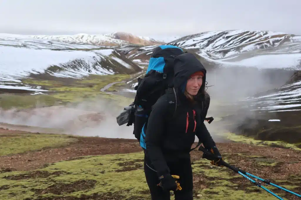
You can access the Highlands only in summer, from June to September, when the F-roads are open. This time period coincides with the Midnight Sun, so you have almost 24 hours of light to explore the area. Ola and I visited in August.
The temperature in summer hovers around 41–54°F (5–12°C) at day and around 34–41°F (1–5°C) at night. You can expect frequent downpours, a lot of headwinds, and even snow in the Icelandic Highlands.
During winter, you can reach Landmannalaugar only via super jeeps or snowmobile/ skidoo driven by skilled drivers, provided that the roads are open. The standard 4×4 jeeps won’t make it. As tour guides working in Iceland, we would only recommend winter travel in a super jeep driven by a local driver.
Where to Stay in Landmannalaugar?
Landmannalaugar has a hut operated by the Iceland Touring Association (Ferðafélag Íslands/ FÍ). You can either stay there or in your tent that you can pitch at the campsite. You can also stay in your campervan.
Landmannalaugar Hut
The cost of staying in the hut per person per night is 15,800 ISK (118 USD). It has a capacity of 78 people, and you need to make your booking well in advance.
You can book the hut from FÍ’s official website. Since Landmannalaugar is one of the most popular tourist spots in Iceland, the hut can be booked in late winter and early spring as well. For that, you need to contact FÍ management via call or email.
The hut only provides sleeping space in halls and quarters, which you have to share with other guests. You need to bring your own sleeping bags and blankets with you. The hut is slightly heated so these don’t have to be arctic-grade.
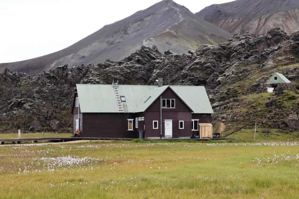
The kitchen of the hut is fully equipped with utensils, gas stoves, and hot running water. There is also a charcoal grill outside, and a connected toilet/shower house (with plenty of space and hot water, thanks to geothermal activity).
The travelers must adhere to the hut rules, such as respecting quiet hours and cleaning up after themselves.
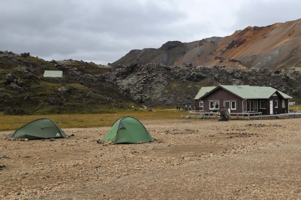
Landmannalaugar Camping
If you want to stay at a campsite in your own tent, it will cost you 3,200 ISK (24 USD) per person per night. Unlike hut, you don’t need to make an advance booking as there’s plenty of room.
Also, you need to bring your own cooking gear, utensils and stove, as you can’t use the kitchen or other indoor facilities in the hut.
The campsite offers a shared dining tent where all the hikers can meet and socialize. There are usually some leftovers (like instant food, spices, camping gas, etc) to take from people who have finished the hike, so that’s a win.
Ola and I experienced both – we stayed in the tent as well as the hut. Staying in your own tent is a more affordable and more private experience. But for the downsides, you need to carry a lot more gear and have to cook “outdoors.”
Also, you can sometimes be exposed to extreme weather conditions. In windy weather (and that applies to the whole of Iceland), pitching a tent can be really challenging. The winds in Icelandic highlands can be very strong, besides being extremely cold.
The travelers who don’t stay the night in the hut or the campsite have to pay a facility fee of 700 ISK (5.2 USD) for using the Landmannalaugar bathing place, outdoor grill, and other facilities.
Our Camping Experience
We found a cozy food truck (made from old converted buses) at the campsite. It was worth stopping for warm soup or a local hot dog. The staff was very welcoming and we just loved the vibe.
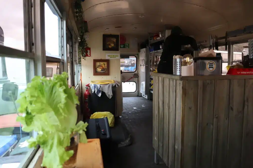
Also, one of the buses sells camping supplies and groceries. Considering the size of the bus we were truly surprised by how many items they had on offer.
The campsite also has a hot spring located very close to it, where travelers can enjoy a well-deserved bath after hiking the nearby trails.

However, visiting the spring during the afternoon or evening usually means more tourists there, so be ready to share it with others.
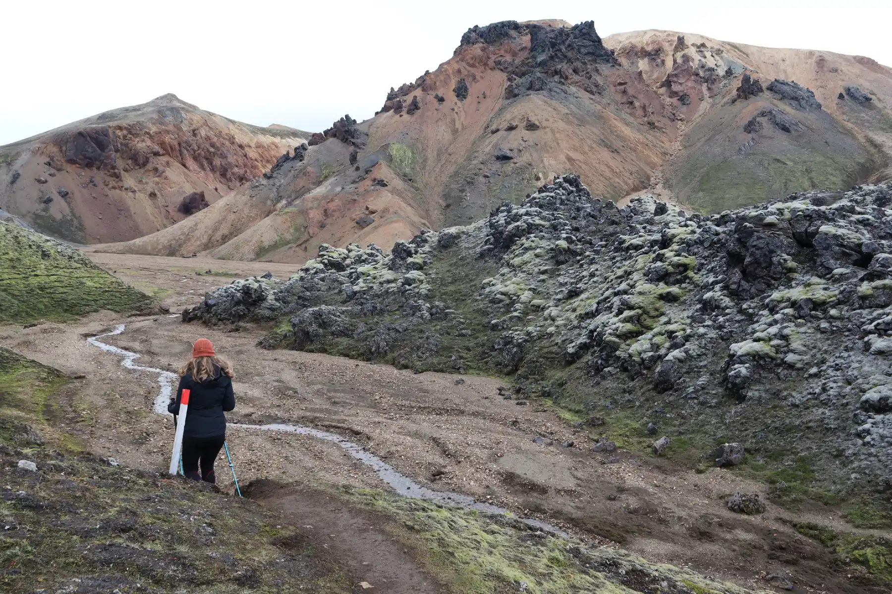
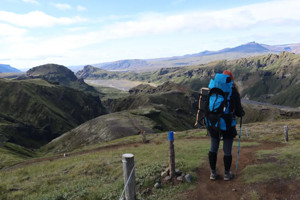
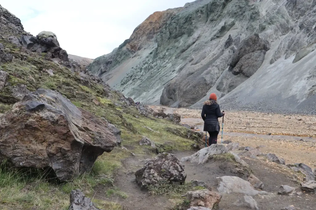
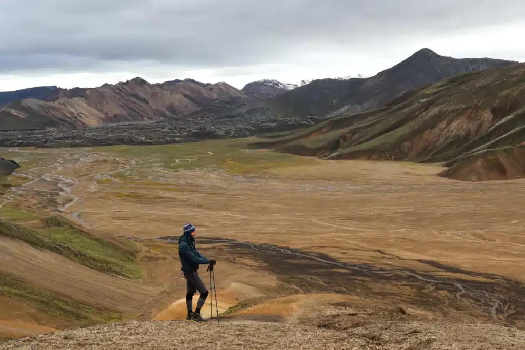
Best Landmannalaugar Hikes
Landmannalaugar offers both one and multi-day hikes. The hikes vary from easy to moderately difficult… one of the reasons behind its popularity is that it has a trail for every hiker. Ola and I have done the following so far.
Laugavegur Trail
- Distance: 55 km (34.19 mi)
- Trail type: One way
- Time: 4-5 days (if you don’t hike the Fimmvörðuháls)
- Difficulty: Moderate
The Laugavegur trail is considered the most popular hike in Iceland with spectacular views throughout.
The distance is around 55 km (34 miles) from Landmannalaugar to Thorsmork, with the hike usually taking 4-5 days to complete. From lakes, riverplains, and waterfalls to deserts, volcanoes, and lava fields, you’ll practically witness every type of landscape during your journey.
| Day | Start | End | Distance | Time | Elevation | Mostly |
|---|---|---|---|---|---|---|
|
1 |
Landmannalaugar |
Hrafntinnusker |
12 km |
4-5 hrs |
600m → 1,141m |
Ascent |
|
2 |
Hrafntinnusker |
Álftavatn |
12 km |
4-5 hrs |
1,141m → 537m |
Descend |
|
3 |
Álftavatn |
Emstrur |
16 km |
6-7 hrs |
537m → 465m |
Descend |
|
4 |
Emstrur |
Thorsmork |
15 |
6-7 hrs |
465m → 200m |
Descend |
You can also extend the Laugavegur trail by hiking the Fimmvörðuháls trail, which connects Thorsmork to Skógar. This adds another 26 km (15 miles) to your hike, requiring another 2-3 days.
Laugavegur Trail Map & GPX
Landmannalaugar-Hrafntinnusker

- Distance: 12 km (6.88 mi)
- Trail type: One Way
- Time: 4-5 hours
- Elevation: 2115 ft – 3676 ft
- Difficulty: Easy
If you want to experience the Laugavegur trail but don’t want to do a multi-day hike, you can just do the first day of the hike. The trail section from Landmannalaugar to Hrafntinnusker is nothing but a feast for the eyes… with colorful rhyolite mountains, extensive lava fields, steaming volcanoes and even snow fields.
Landmannalaugar-Hrafntinnusker Map & GPX
Laugahraun
- Distance: 5.32 km (3.31 mi)
- Trail type: Loop
- Time: 1-2 hours
- Elevation: 1982 ft – 2342 ft
- Difficulty: Easy
Laugahraun lava field offers an easy-to-do hike for kids, dogs, and people of all ages. It was formed by an eruption in 1477.
This is probably the most popular Landmannalaugar hike, so you can expect a lot of people and guided tours here. It passes through the area with hot steam, and finishes by following a stream surrounded by greenish, colourful mountains.
Laugahraun Map & GPX
Landmannalaugar - Brennisteinsalda
- Distance: 6.5 km (4.32 mi)
- Trail type: Loop
- Time: 2-3 hours
- Elevation: 1900 ft – 2815 ft
- Difficulty: Moderate
The hike from Landmannalaugar to mount Brennisteinsalda (also called the Sulphur Wave or Orange Mountain) has breathtaking views. You will walk through a field of solidified lava with sulphuric steam vents all around, before summiting the Brennisteinsalda peak.
Landmannalaugar - Brennisteinsalda Map & GPX
Blahnúkúr, Grænagil, Brennisteinsalda
- Distance: 9.55 km (5.94 mi)
- Trail type: One Way
- Time: 4-6 hours
- Elevation: 1954 ft – 3135 ft
- Difficulty: Moderate
If you have just one day and you can do only one Landmannalaugar hike, this is what you should be aiming for. This hike combines a number of panoramic views: lava fields, steaming fumaroles, zig-zag trails, and lots of yellow, orange, and brown mountains. Can you think of a better day hike?
Blahnúkúr, Grænagil, Brennisteinsalda Map & GPX
Grænihryggur
- Distance: 15.64 km (9.72 mi)
- Trail type: Loop
- Time: 6-8 hours
- Elevation: 1754 ft – 2601 ft
- Difficulty: Moderate
Leading through a remarkably diverse terrain, the Grænihryggur hike is a hidden gem with almost no visitors. Even though it’s an official hiking trail, you’ll rarely find a hiker on this stunning path. Grænihryggur or the “Green Ridge” offers vibrant colours and a memorable experience.
Grænihryggur Map & GPX
Suðurnámur
- Distance: 8.5 km (5.33 mi)
- Trail type: One Way
- Time: 3-4.5 hours
- Elevation: 1939 ft – 3010 ft
- Difficulty: Easy
This trail starts in the colorful canyon and then continues uphill following the mountain ridge with beautiful views of magma fields and surrounding mountains. The route eventually leads down onto the grassy plateau, where sheep are often spotted, and then continues back to the campsite through the magma fields and part of the Laugahrun hike. We only met one hiker on the trail, when hiking through the mountains.
Suðurnámur Map & GPX
Note: These are not the only Landmannalaugar hikes, there are plenty of other hiking trails in the area. Ola and I are planning another visit, so we will be adding more hikes to this list later.
Landmannalaugar vs. Kerlingarfjöll
Landmannalaugar and Kerlingarfjöll are often compared. Both are extremely beautiful and have excellent hiking trails. But, they have some differences too.
For those unfortunate travelers who have to choose between any of these two destinations due to paucity of time or any other reason, here’s a brief comparison of the two.
- Landmannalaugar is the most popular hiking destination in Iceland, so it’s more crowded than Kerlingarfjöll. On the upside, it has better accessibility, with several buses operating everyday.
- Kerlingarfjöll isn’t just more secluded, it’s also more “other-worldly” with unique landscapes. Ola and have had an amazing experience there. Landmannalaugar, on the other hand, has a more scenic route.
- When it comes to lodging, Landmannalaugar only has the FI hut where you just get space for your bedding and have to share the accommodation with other guests. Kerlingarfjöll, in contrast, has Highland Base Resort, which is a luxurious hotel.
- Landmannalaugar has a number of trails with various lengths and difficulty levels. Kerlingarfjöll has a higher elevation with comparatively difficult trails.
- Hveradalir and other interesting areas in Kerlingarfjöll are located some distance away from the resort, so some hiking is required to access them. Landmannalaugar hikes are close to the basecamp and more easily accessible.
To sum up, both destinations are unique in their own way… and you really can’t go wrong with either option. We really hope you don’t have to choose between these two.
Photography & Must-See Sites
Landmannalaugar is a heaven for photography enthusiasts. Some of our favorite areas are:
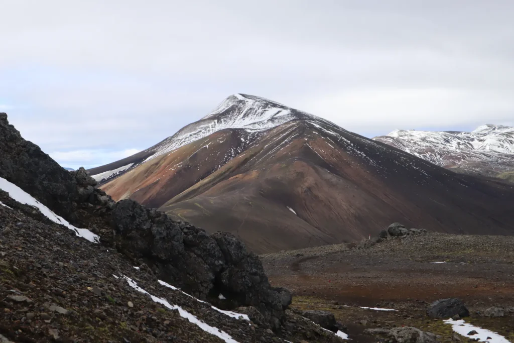
Rainbow Mountains
The mountains of Landmannalaugar are often linked to rainbow-colored cake mountains due to the vibrant hues of red, orange, pink, green,and blue.
This otherworldly appearance is caused by the rhyolite rock, the region’s volcanic and geothermal activity, and mineral-rich soil. The colors are really stunning, so make sure to bring your photography gear to picture this beauty.
Ljotipollur Crater Lake
A striking contrast from the stunningly deep-blue lake to the steep bright-red crater makes Lake Ljotipollur one of the jewels of Landmannalaugar.
This explosion crater is a popular spot for photographers due to its astounding clarity and color features. You can appreciate its beauty from the edge or with a drone for aerial photography. Yes, it may not compare with Stokksnes beach in magnanimity, but still, will steal your breath.
Brennisteinsalda River
With a wide-angle lens and a polarizing filter, you can capture the scenic beauty of the Brennisteinsalda River. It’s known for its unique combination of vibrant hues, caused by sulphur deposits and geothermal activity, with steam rising from hot springs.
You need to hike to Brennisteinsalda to access this picturesque river. So, a stunning hike leading to a stunning reward!
Hnausapollur or Bláhylur Crater Lake
Hnausapollur, also called the Bláhylur, is a turquoise blue crater lake that looks like it’s from another planet.
Located right next to road 208 north of Landmannalaugar, it’s a popular stop for visitors and photographers. The view at the top is striking and the lush green hills during summers make it even more interesting for nature photographers.
Valley of Tears, Sigöldugljufur Canyon
Sigöldugljufur, fondly known as the ‘Valley of Tears’, is a true gem in the Icelandic Highlands near Landmannalaugar. The azure blue pools and streams formed from numerous mineral-rich glacial waterfalls cascading down an impressive canyon provide an eye-catching view.
A wide-angle lens and a drone to capture this true gem in the morning and at sunset would be worth every penny.
Stútur Crater
Cherished for its absolutely stunning landscapes and astonishing geothermal activity, the Stútur Crater is a fascinating site for photography due to its colorful rhyolite rocks, steaming hot springs, unique volcanic activities, steep crater walls, and mineral-rich soil.
It’s quite an old volcano covered by moss and is a well-kept secret from the crowds. If you want to witness the insides of the volcano, take a three-sixty degree view of the area around it and capture the intricate details of the Stútur Crater. The only thing you need to this practically is an easy hike to the top!
Landmannalaugar Hot Spring
Landmannalaugar, which translates to “people’s pool,” has historically been known for its natural geothermal hot springs. The most popular pool is located next to the Laugahraun lava field, at a 5 minutes’ walk from the campsite.
Relaxing in this geothermal hot spring is the perfect reward after any day of hiking in the area. This is especially true after you’ve hiked the Laugavegur trail in reverse (south-north) route, that starts from Thorsmork and ends at Landmannalaugar.
Thanks to geothermal activity, the temperature of this pool remains 36–40°C (97–104°F) throughout the year. It’s not only a natural Landmannalaugar bathing place, but also a picturesque spot with the backdrop of colorful mountains and scenic landscapes.
What to Pack?
This totally depends on the length and nature of your trip. For a one-day trip, pack the following:
- Layered clothing
- Waterproof jacket/pants
- Hiking shoes & extra socks
- Offline Landmannalaugar hiking map/GPS
- Swimsuit & towel (for hot springs)
- Sunscreen, sunglasses
If you’re planning a multi-day hike, you need to pack accordingly. We have provided a detailed packing list for such hikes in our detailed packing guide.
As tour guides working in Iceland, we know well that the weather here is really unpredictable. Even when the forecast is fine, the conditions may change fast. Always be prepared for wind, rain, and sun. Pack light and carry just the essentials.
Travel Tips
Do a thorough research before you go, or book a guided tour.
Use a 4WD vehicle with bulletproof insurance.
Make sure to fill your tank. There is no petrol station in or around Landmannalaugar.
Don’t trespass, as the vegetation can be delicate.
The weather may change in a split second, so be prepared for all conditions.
If you're planning a multi-day hike, plan and pack accordingly.
Make all bookings in advance, as huts are often fully booked.
The trails in Icehandic Highlands have no mobile connectivity, carry GPS device and offline Landmannalaugar hiking map.
Interesting Facts
Fascinating Geology
Landmannalaugar is a captivating landscape located within the Torfajökull Volcanic System in Iceland’s Fjallabak Nature Reserve in the Highlands.
The area is famous for its natural geothermal activity, lava fields, volcanic craters and vibrant mountains. These stunning mountains are composed of rhyolite — a volcanic rock formed from the slow cooling of silica-rich magma, resulting in unique patterns and a wide spectrum of vibrant hues.
Delicate Flora
Despite the harsh volcanic conditions, Landmannalaugar has a remarkably diverse flora including:
- Mosses, fungi, lichen, and lupine
- A variety of wildflowers with hues of green, yellow and blue
- Mountain avens: Also called Holtasóley, it’s a white Artic-alpine flower which also happens to be the National flower of Iceland
- Arctic thyme: Also called the Blóðberg, it’s a popular culinary plant
Wild Fauna
Landmannalaugar is also home to many bird species and a few mammal populations.
- Snow Buntungs, having distinctive white and black plumage
- A large diving bird called the Great Northern Loon, and a small diving bird named the Red-throated Loon
- Arctic Foxes, which are the only native Icelandic mammals
- Minks are also occasionally spotted
Summary
Landmannalaugar is located in the Fjallabak Nature Reserve in the southern Icelandic Highlands. The region is known for its geothermal hot springs, breathtaking lava fields, colorful rhyolite mountains, and lots of stunning hikes.
The driving distance from Reykjavik is around 3 hours and 15 minutes. The area can be accessed via a 2WD car in summer months when the weather is good. But as someone who is working in Iceland as a tour guide, I’ll always recommend a 4WD vehicle on the F-roads.
All visitors traveling in private or rental vehicles and arriving between 9am-4pm, from 20th June to 14th September need to reserve their parking space via parka.is website or app. No reservations are needed otherwise. However, all vehicles have to pay a service fee.
As for accommodation, you can either stay in a FI hut that charges 15,800 ISK (118 USD) per person per night or you can pitch a tent at the campsite by paying 3,200 ISK (24 USD) per person per night. If staying in the hut, you need to bring your sleeping bag and share the space with other guests.
The travelers staying at Landmannalaugar camping site can’t use indoor hut facilities and have to bring their own cooking gear. They can, however, use the toilet/shower place for a fee. There’s also a hot spring at a 5 minutes’ walk from the campsite.
Landmannalaugar has a number of trails with various lengths and difficulty levels, so it’s just the perfect hiking destination for almost everyone. This is one of the reasons why Landmannalaugar is more crowded than Kerlingarfjöll, Hvannagil, and other hiking areas.
There are a number of stunning day hikes that you can undertake. Otherwise, you can hike the epic Laugavegur trail, which runs from Landmannalaugar to Thorsmork and requires at least 4 days to complete. The trail is 55 km (34 mi) in length and can be extended by another 26 km (15 miles) if you further hike to Skógar via the Fimmvörðuháls trail.
If you have any questions, feel free to leave a comment!
Facebook
Pinterest
LinkedIn
Twitter
How do we rate this location?
FAQ
How far is Landmannalaugar from Reykjavik?
It’s a 3 hour 15 minute drive from Reykjavik. The distance is around 187 km (116 miles).
Which vehicle should I drive to Landmannalaugar?
We’d recommend a 4×4 vehicle.
Which is the easiest route to Landmannalaugar?
The Northern route (F26, F208, F224) is the easiest, with just one river crossing on F224 that you can avoid by parking your car and using the overhead bridge.
Is there any fee for visiting Landmannalaugar?
Yes, all vehicles have to pay a service fee. It’s 600 ISK (4.7 USD) for a motorbike, 1200 ISK (9.4 USD) for a car with up to 5 seats, and 2000 ISK (15.6 USD) for a car with 6 to 9 seats.
Is any reservation needed for visiting Landmannalaugar?
All visitors traveling in private or rental vehicles and arriving between 9am-4pm, from 20th June to 14th September need to reserve their parking space via parka.is website or app.
What is the easiest hike in Landmannalaugar?
The Laugahraun lava field hike is the easiest. It takes 1-2 hours to complete and is perfect for people with kids or dogs.
If I visit by bus, will I get enough time to explore?
Yes, if you arrive and depart by bus on the same day, you can still have 5-6 hours to explore the area and do a day hike.
> YOU MAY ALSO LIKE

Crystal Ice Cave Tour at Jökulsárlón – Review in 2025
20 January 2026
No Comments

Diamond Beach in Iceland: Your Ultimate Travel Guide
7 January 2026
No Comments
TABLE OF CONTENTS