
Mulagljufur Canyon – The Complete Hiking & Travel Guide
- GoAndXplore
- No Comments
Mulagljufur Canyon – The Complete Hiking & Travel Guide
- GoAndXplore
- No Comments
Facebook
Pinterest
LinkedIn
Twitter
Mulagljufur Canyon, aka “Mules Canyon,” is a breathtaking natural wonder in southeast Iceland.
This majestic gorge is known for its dramatic cliffs, cascading waterfalls, and untouched wilderness. Once a “hidden gem,” Mulagljufur receives more and more attention and tourists each year.
It’s still one of Iceland’s most pristine and “untouched” destinations, where one can truly rest and at the same time take amazing photos.
Ola and I have already visited the canyon three times, and that should speak for itself. If you’re planning to explore Mulagljufur, here’s everything you need to know.
TABLE OF CONTENTS
Where is Mulagljufur Canyon in Iceland?
Mulagljufur is located in Vatnajökull National Park in the southeast region of Iceland. It lies between Skaftafell and Jökulsárlón, and is accessible by the Ring Road. Vatnajokull, established in 2008, is the largest national park in Iceland.
Here’s the location on Google Maps
How to Get to Mulagljufur Canyon?
As of now, no bus service operates to the area so the only way to get to Mulagljufur Canyon is to drive. In case you don’t want to drive yourself, you can join a guided tour.
Let us have a look at both of these options.
How to Drive to Mulagljufur in Iceland?
Mulagljufur is 372 km (231 miles) away from Reykjavik, so you can easily drive yourself. The journey will take about 4 hours and 30 min. via the Ring Road (Route 1).
Working here in Iceland as guides, we often get questions about how it’s with the road access to the trailhead and when to turn to Mulagljufur Canyon from the Ring Road.
Well, the access road used to be quite rough, but now it’s in much better shape and easy to drive on.
As for the turn from ring road, there was previously no official sign showing direction. It was very common for tourists to miss the turn to Mulagljufur and many would turn back from Jökulsárlón glacier lagoon and Diamond Beach.
But fortunately, that’s not the problem anymore.
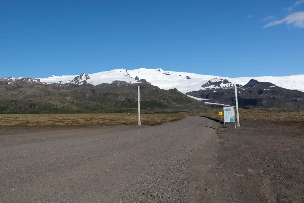
A new parking area has been recently developed for people visiting the canyon, approximately 1.5km after the turn to Mulagljufur Canyon from Route 1.

And thanks to the camera gate (1st pic), the turn from the Ring Road is now easier to recognize.
After you park your car, you will need to walk another 7-8 minutes to access the trailhead.
How Much Mulagljufur Canyon Parking Costs?
The parking fee depends on the number of seats in the car. It’s 1000 ISK for a vehicle up to 7 seats. Visitors have to pay via the Parka app.
The fee at Mulagljufur Canyon parking only applies if vehicles are parked for more than 10 minutes. It remains valid until midnight each day.
The fee will be used for the maintenance of Mulagljufur Canyon parking lot as well as for the development of the area.
Here’s the fee for different types of vehicles:
| Vehicle Seats | Parking Fee (ISK) |
|---|---|
|
1-7 |
1000 |
|
8-14 |
2000 |
|
15-22 |
3000 |
|
23-44 |
4000 |
|
45+ |
8500 |
For more details about Mulagljufur Canyon parking fee, please visit Parka.is.
What Car to Use to Get to Mulagljufur?
This depends on the time of the year you’re visiting. In summer, you can use a 2WD car. But keep in mind that conditions of gravel roads in Iceland changes and you should drive with caution.
In winter, the road can get extremely slippery due to ice and snow. If conditions allows, you might still be able drive your 2WD there, but it can be risky.
The safest option for winter travel in Iceland is to use 4WDs or super jeeps.
Are There Any Guided Tours to Mulagljufur?
In case you don’t want to drive yourself, you can visit Mulagljufur with a guided tour. But unfortunately, you don’t have many options.
Mulagljufur has been a hidden and somewhat lesser known destination, which is also what makes it so special, and as of now, we couldn’t find a tour operator offering a direct tour to Mulagljufur.
However, you can still join broader South Coast tours that include Mulagljufur as part of their itinerary. While selecting a tour operator, try to aim for the ones that are environmentally responsible as with growing number of tourists each year, responsible tourism becomes critical.
When Should You Visit Mulagljufur Canyon?
You can visit Mulagljufur year round, but Summer is the best time to go. It’s because the roads are easier to navigate, hiking is safer, and there’s plenty of daylight.
If you ask us, we’d suggest to visit anytime from June to September. During these months, the temperature ranges from 10°C to 15°C (50°F to 59°F). Since the snow has melted, you get to see a vibrant landscape.
Both the road and the hiking trail are safer compared to any other time of the year. Moreover, you get up to 22 hours of daylight, so have ample time for exploration and photography.
Traveling in Spring and Autumn is still better than winter. However, in case of rainfall both the road and the trail may get slippery and muddy. You may need a 4WD to access the canyon and better gear to safely hike the trail.
In winter, the roads can get partially or completely blocked due to snow and ice. The terrain may get extremely slippery requiring a super jeep or modified 4×4 vehicle for safe travel.
Seasonal Comparison
Here’s a brief summary of what you can expect when visiting Mulagljufur Canyon in different seasons.
| season | Summer (Jun-Aug) | Autumn (Sep-Nov) | Winter (Dec-Feb) | Spring (Mar-May) |
|---|---|---|---|---|
|
Weather |
Milder (10-15°C), occasional rain/wind |
Cooler, increasing rain/wind |
Cold, snow, ice |
Variable, can be cold, rain, melting snow |
|
Daylight |
20-22 hours |
10-14 hours |
4-7 hours |
13-18 hours
|
|
Road Conditions |
Generally best, 2WD possible with care |
Can be difficult with snow/ice, muddy, slippery gravel |
Treacherous, blocked by snow/ice
|
Can be difficult with snow/ice, muddy |
|
Trail Conditions |
Snow melted, lush, wildflowers, easier |
Muddy, slippery |
Impossible to navigate, snow/ice mask terrain |
Muddy, slippery, uneven terrain |
Where to Stay When Visiting Mulagljufur?
Mulagljufur Canyon is a day-trip destination, so it does not offer any on-site accommodation. Visitors can, however, stay in nearby towns and villages. You can find lodging options around the Jokulsarlon Glacier Lagoon and Skaftafell Nature Reserve areas.
As a matter of fact, the absence of lodging options at the canyon is one of the reasons behind its untouched and natural state.
Hotel Jokulsarlon is a luxurious lodging option, located just 15.6 km from Mulagljufur. Hotel Skaftafell is another good option, located 40km from the canyon. You can also find a number of guest houses on budget.
Alternatively, you can pitch up a tent at Skaftafell campsite. It’s just 45km away from the canyon, with the drive taking just over 40 minutes. The campsite offers an affordable lodging option, besides enabling you to experience Icelandic wilderness in all its glory. What else you can want?
We’ll soon be publishing our experience at Skaftafell, so stay tuned.
Mulagljufur Canyon Hike
-
Distance:
5.5 km
-
Trail Type:
One way
-
Time:
2 hour 30 minutes
-
Difficulty:
Moderate
-
Elevation +
355 m
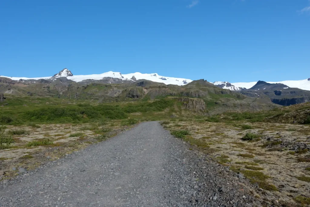
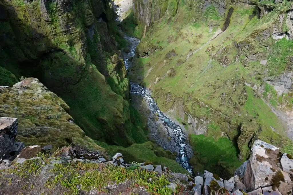
Mulagljufur Canyon hike is one of the most pristine and untouched hikes you will find in Iceland. It’s a relaxing walk into a fairytale-like landscape with breathtaking views.
Trail Difficulty
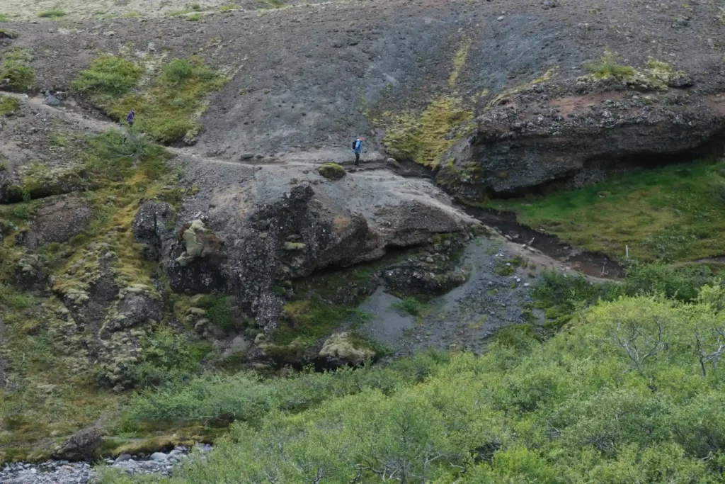
The path is relatively easy to follow, but is not well marked. People may get confused as at points the old trail overlaps with the new one.
The national park use rocks and fences to distinguish the new trail from the old one, but despite that, we saw tourists trespassing. Hard to say whether they did it on purpose for better shots or by mistake, but we would like to encourage everyone to stick to the path.
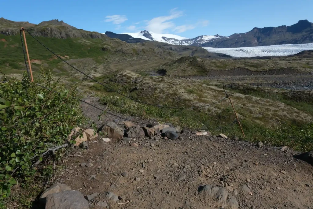
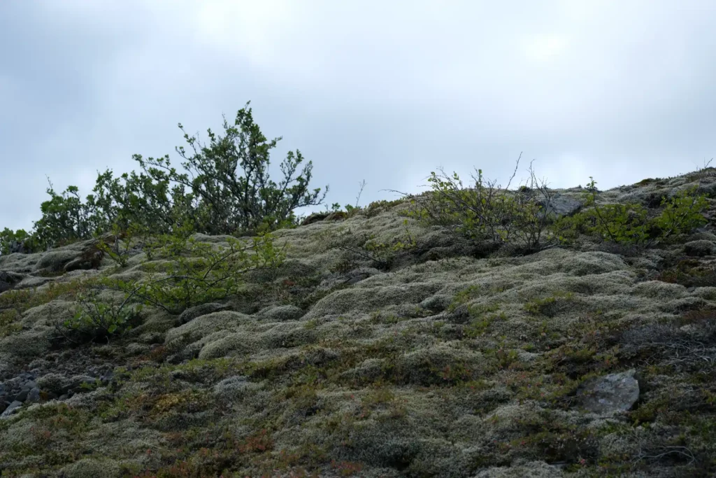
Please keep in mind that vegetation in Vatnajokull National Park is very delicate and all moss is legally protected due to decades long recovery and its critical role in Icelandic ecosystem.
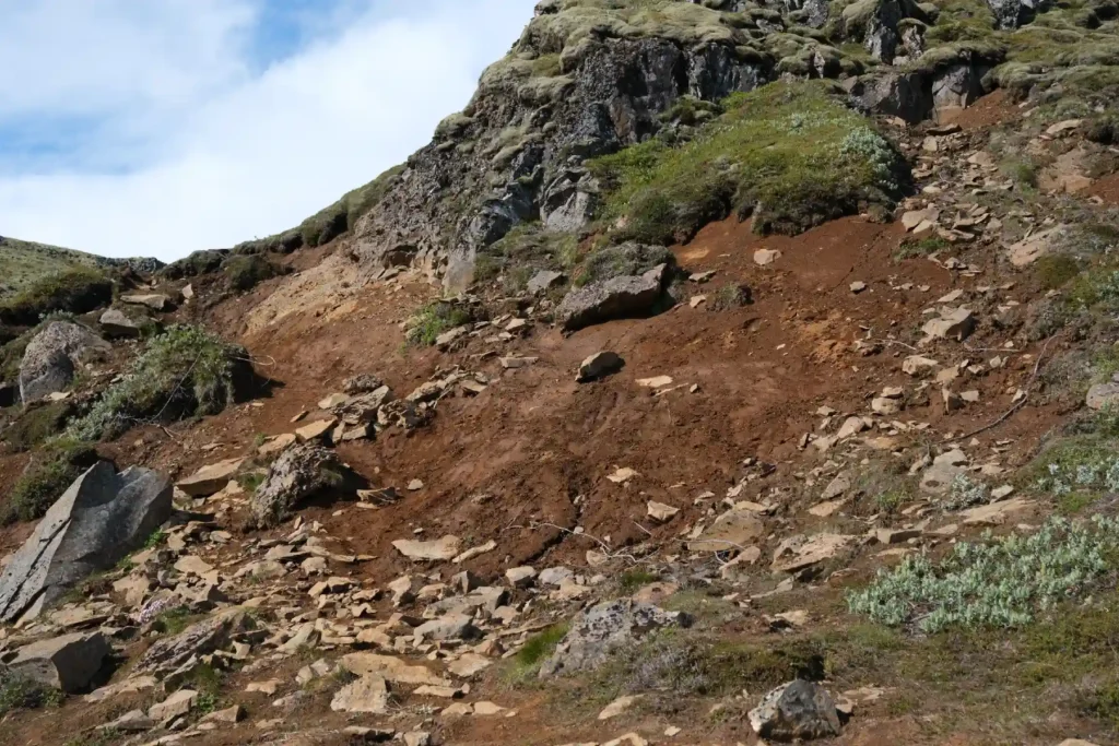
At some points, the trail winds through overgrown bushes and loose rocks. So be extra cautious when raining or in wet conditions. The overall trail difficulty is moderate, especially when aiming for the second waterfall which requires overcoming quite steep incline.
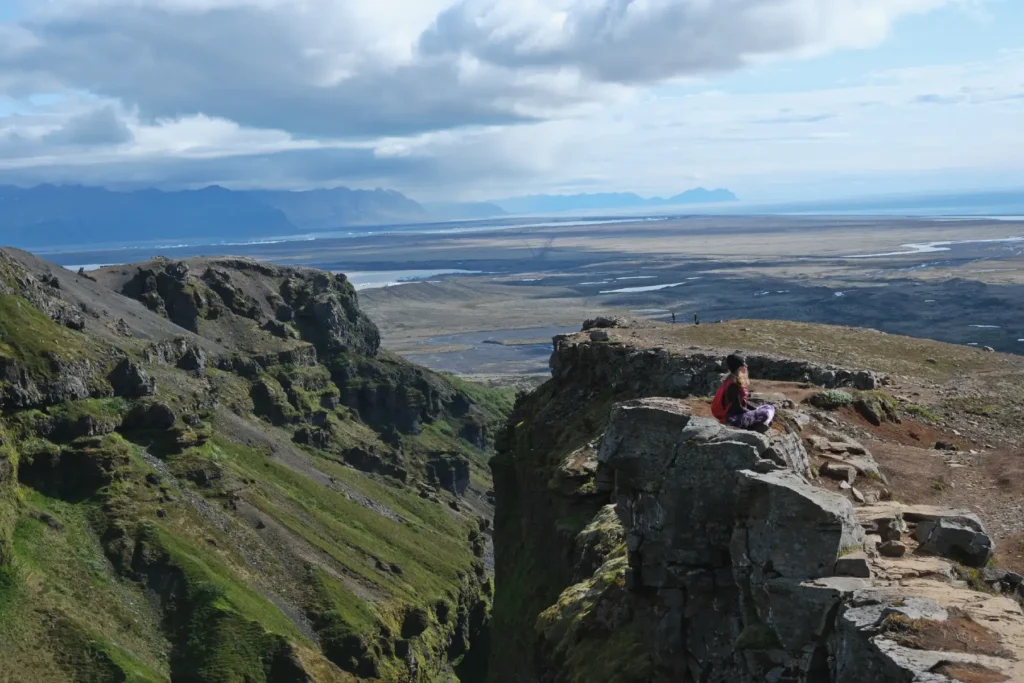
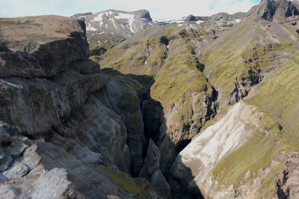
Rewarding Viewpoints
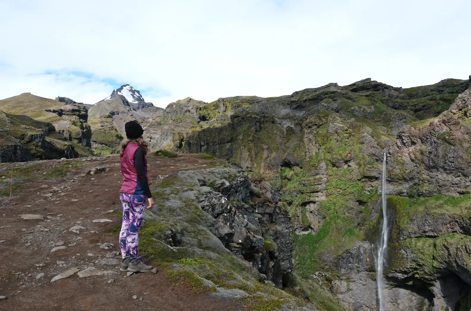
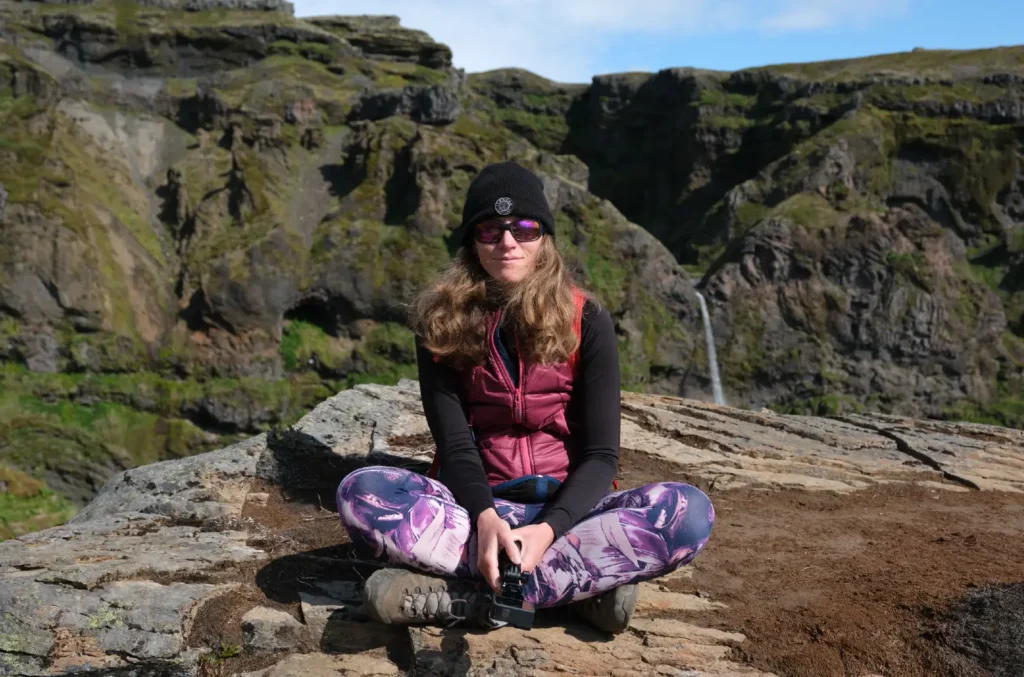
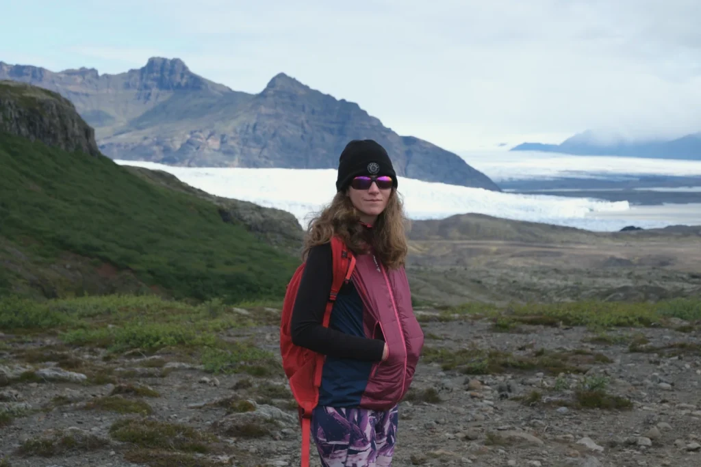
Ola and I found Mulagljufur Canyon hike to be extremely rewarding, with stunning views of surrounding glaciers, lagoons, and snow-capped mountains.
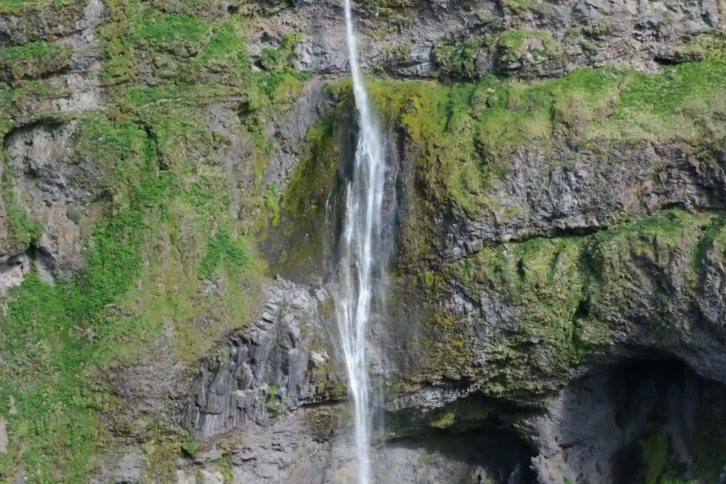
We loved the initial viewpoint of Hangandifoss. It’s one of the tallest waterfalls in Iceland. It also reminded us of our recent visit to Svartifoss.
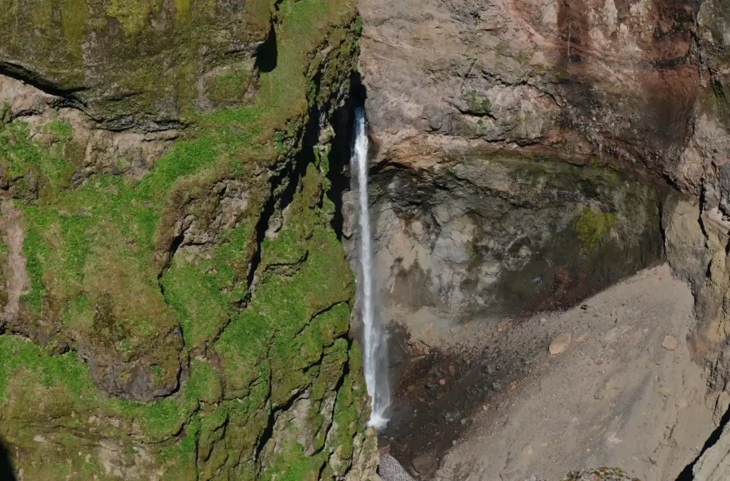
As you continue your ascent, you come across the second waterfall, Múlafoss. This waterfall is tucked deeper within the canyon.
The uphill section from Hangandifoss to Múlafoss involves walking on a relatively narrow ledge with exposure on the right side. Hikers should be extra careful here as consequence of falling can be catastrophic.
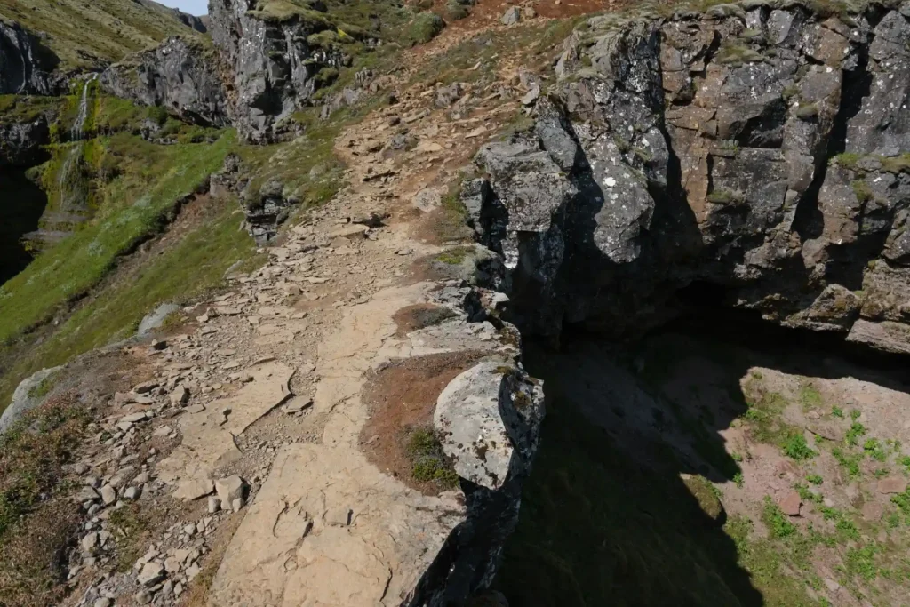
The Hangandifoss to Múlafoss section is steeper than the rest of the Mulagljufur Canyon hike. It’s also quite muddy in some parts.
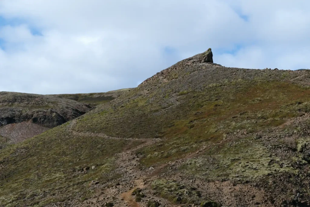
After Múlafoss, the trail continues to climb the gravelly hillside and leads to higher natural viewpoints.
These elevated points provide a more direct look down into the canyon and are perfect for photography. The view back towards the sea is absolutely stunning.
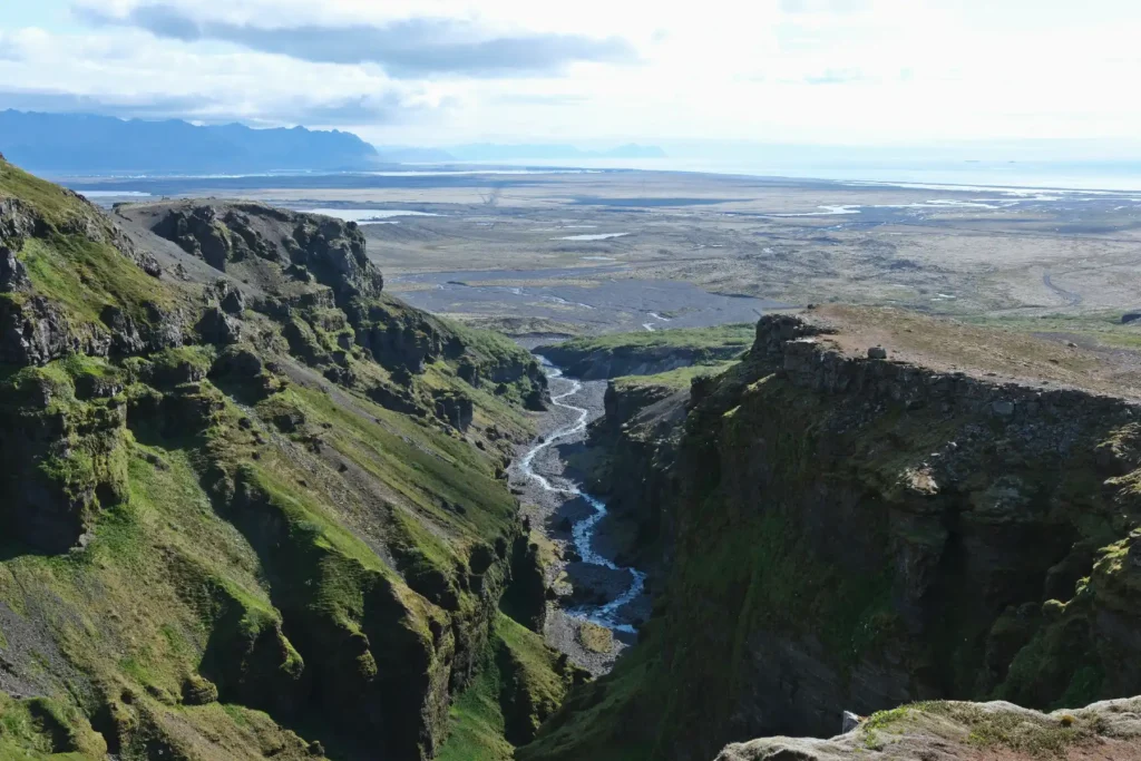
As you make your way on Mulagljufur Canyon hike, you can also capture the majestic cliffs in front of the nearby glacier tongue, Hrútárjökull. You will never find a better contrast of rock and ice than here.
Water Streams
You need to cross two small water streams to reach the canyon rim. The first one is located just 200m after the trailhead. The water is running, and in our opinion safe to drink. If needed, you can refill your water bottles here.
The other stream is in the middle of the hike and it’s wider than the first one. To reach the stream, the trail goes quite steeply down.
This section has dust and loose rocks, which converts into mud on rainy days. Almost everybody slows down here and it can get little jammed, be careful to not slip here.
Mulagljufur Hike Map & GPX
Photography in Mulagljufur Canyon
Mulagljufur has real potential for amazing photographs, especially when visiting during the golden hour or in foggy, misty conditions. We took some really nice photos there and most likely will visit the place again to capture even more.
In addition to the canyon itself, the following points are perfect for photography.
Hangandifoss
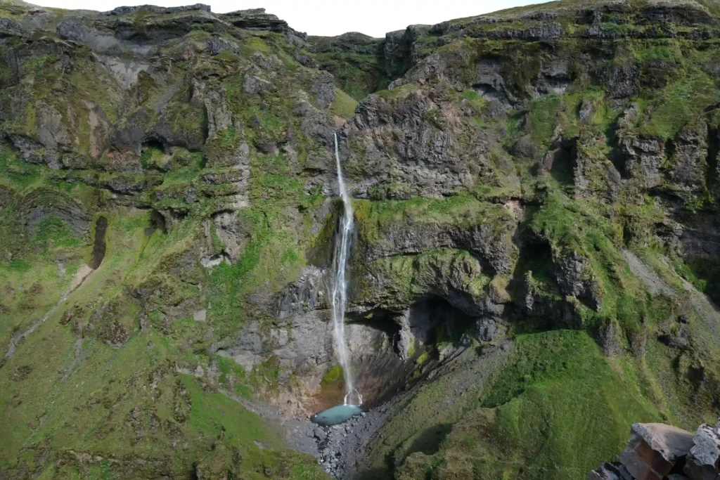
Also known as the “Hanging Falls,” this is one of Iceland’s tallest waterfalls, at 123 meters (403 feet).
The waterfall is clearly visible from almost all main viewpoints along
the trail. If you like photography, you can try taking a wide-angle shot
to capture its full height against the canyon walls.
Múlafoss
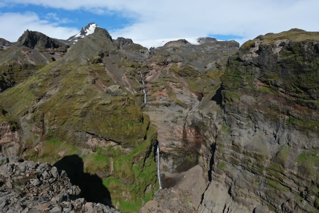
This is a smaller waterfall at 101 meters (331 feet), so can be a bit more challenging to spot from some viewpoints on Mulagljufur Canyon hike.
But as you reach closer to it, you get to see a stunning cascade with an even more stunning backdrop.
Múlakvísl River
The Múlakvísl river, also known as the Múlaá river, flows through the canyon and feeds into the waterfalls. It’s primarily spring-fed, but is also fed by the melting snow from the Öræfajökull.
The winding path of the river contrasting with the rugged canyon walls offer a great opportunity for photographers.
Hrútárjökull and Rótarfjallshnúkur
Hrútárjökull glacier tongue is visible in the first half of the hike, creating nice contrastic layers together with mountains and lush greenery.
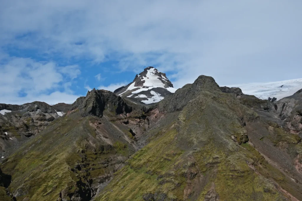
Moreover, you can also capture Rótarfjallshnúkur peak in contrast with surrounding mountains.
What to Pack for Mulagljufur Canyon?
For a day trip, you need to pack the following.
Essential items:
- Waterproof hiking boots
- Weatherproof jacket & warm layers
- Water bottle
- Snacks or lunch
- GPS / Offline maps
- Camera
- First aid kit
Optional items:
- Hat & gloves
- Trekking poles
- Sunglasses & sunscreen
- Extra socks
- Power bank
Keep in mind that Icelandic weather is unpredictable and can change fast. Always get prepared for all possible condition, the wind, rain, and sun.
For more details on how to pack for trip to Iceland, you can check our packing guide.
Mulagljufur Travel Tips
Research and plan your trip accordingly. There are no toilets or other facilities around Mulagljufur.
Check weather conditions (vedur.is) and road conditions (road.is) before your trip.
Exercise extreme caution near cliff edges, keeping at least a body length (2m) distance. Wind gusts in Iceland can be strong and unexpected.
Adhere to the "Leave No Trace" principle to help keep the area in its natural and untouched state.
Stay on marked trails and do not walk on moss as all mosses are protected in national parks. This is crucial for preserving the fragile ecosystem that Icelandic moss is an important part of.
Bring reusable containers for food and water, and ensure that all waste is carried out of the canyon. If you can, please avoid single-use plastics.
Opt for low-emission transportation whenever possible. If driving, choose a fuel-efficient or electric vehicle. Consider carpooling with others or joining group tours.
Always observe wildlife from a distance.
Hidden Spots
Most of the hikers stop at Hángangifoss waterfall, take a few pictures, and then turn around. Some will pursue the trail further, reaching the Múlafoss waterfall, but only few will continue to very end of the path that finishes on the sharp cliff.
Of course, we wouldn’t be proper explorers to not take a look there! This is the view you can expect if you get to the location. With the hidden “no-name” waterfall in the middle.
Interesting Facts
- Mulagljufur was mainly formed due to volcanic activity, which added layers of dark basalt to the cliffs.
- The canyon stretches up to 2 km (1.2 miles) in length and reaches depths of over 400 m (1,312 feet).
- You can spot a number of birds while on Mulagljufur Canyon hike. These include Arctic tern, Icelandic gull, and Eurasian oystercatcher.
- Despite its proximity to the Ring Road, Mulagljufur remained largely unknown to average adventurers due to the lack of signage at the turn to Mulagljufur Canyon. It’s no longer a “hidden gem” but is still unspoiled.
Summary
Mulagljufur Canyon is located in Vatnajokull National Park in southeast Iceland. It is 372 km (231 miles) away from Reykjavik.
As of now, no bus service operates to the area, and the only way to get there is to drive yourself. The drive from Reykjavik takes about 4 hours and 30 minutes via the Ring Road (Route 1).
Until recently, parking was free. But a new parking area has now been developed right after the turn to Mulagljufur Canyon from Route 1. Thankfully, the access road to the canyon is now easier to recognize. The parking fee is 1000 ISK for a 7-seater vehicle, and higher for larger vehicles.
When visiting, please ensure responsible tourism. Stay on marked trails, don’t touch or walk on the fragile moss, and pack out all trash. Carefully plan your visit, and keep in mind that there are no toilets or other facilities at the canyon.
In case of any questions, feel free to leave a comment below. 😉
Facebook
Pinterest
LinkedIn
Twitter
How do we rate this location?
FAQ
Is Mulagljufur worth visiting?
Mulagljufur offers stunning waterfalls and panoramic views without the large crowds often found at more popular sites. Its raw, untouched nature makes it worth visiting.
Can drones be flown at Mulagljufur?
Mulagljufur is part of Vatnajökull National Park. So, drone use is not allowed there unless you have special permission.
How much does Mulagljufur Canyon parking cost?
Mulagljufur Canyon parking costs 1000 ISK for a vehicle up to 7 seats. The parking fee is higher for larger vehicles.
What is the best time to visit Mulagljufur?
The best time to visit is during the summer months (late June to early September). The weather is milder, days are long, and trails are generally in the best condition.
Are there toilets at Mulagljufur Canyon?
No, there are no facilities, including toilets or shops, at the canyon. The nearest toilets are at Glacier Lagoon.
Are there any other nearby attractions to visit?
Yes, Mulagljufur is close to many popular attractions. These include Jökulsárlón Glacier Lagoon, Diamond Beach, Fjallsárlón Glacier Lagoon, and Skaftafell Nature Reserve.
Which vehicle should I take to Mulagljufur?
A 2WD is generally enough, but in winter or snowy conditions opt for 4WD with higher clearance.
Is Mulagljufur Canyon hike difficult for hikers?
The Mulagljufur Canyon hike is moderate. There are some steep and slippery sections, as well as stream crossings, but the hike is not difficult.
> YOU MAY ALSO LIKE

Crystal Ice Cave Tour at Jökulsárlón – Review in 2025
20 January 2026
No Comments

Diamond Beach in Iceland: Your Ultimate Travel Guide
7 January 2026
No Comments
TABLE OF CONTENTS